
New app to change the face of farming
Aerobotics software Aeroview empowers tree crop farmers to identify early-stage problems in their orchards. Used in conjunction with the Aeroview InField app on their smartphone, farmers are able to locate problem areas on a tree-by-tree basis. Aerobotics software Aeroview empowers tree crop farmers to identify early-stage problems in their orchards. Used in conjunction with the Aeroview InField app on their smartphone, farmers are able to locate problem areas on a tree-by-tree basis.
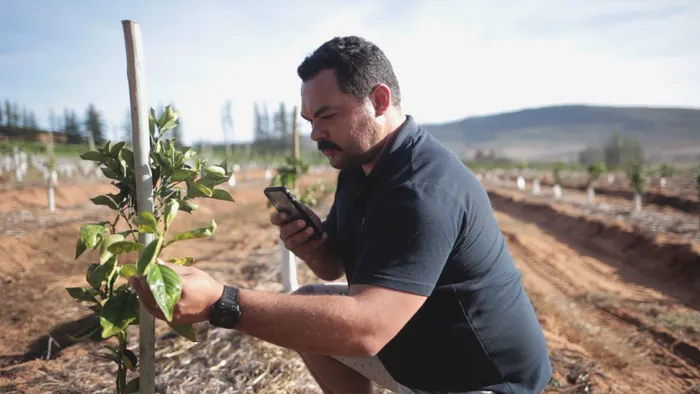
Cape Town - Problems affecting trees and crops on a farm can be located and treated through a cellphone app.
The app, Aeroview InField, is designed by the Cape Town-based agri-tech start-up, Aerobotics and the app uses scouting technology to allow for cutting-edge, convenient and more accurate reporting on crop health.
Aerobotics processes data from drone and satellite imagery through its artificial intelligence (AI) software. Its tools are used to discover and analyse problems affecting individual trees and vines on a farm.
Aeroview InField has been designed on the backbone of an existing app.
The Aeroview InField app.
The biggest change from the initial app, Aeroview Scout, is that you can add more than one marker per tree. This allows for multiple data points and more precise data capturing.
Markers can be accompanied by custom notes, photos taken on a cellphone and data from field problems.
Farmers are able to pay R50 per hectare per month and have three drone flights per crop season from a certified drone pilot, or R30 per hectare per month to fly their own drone and receive the data from Aerobotics.
Aerobotics is in 18 countries and has covered more than 100000 hectares of farmland with more than 27 million trees captured by Aerobotics’ AI systems.
According to chief operations manager Tim Willis, more than 1000 farmers are using the app.
“Technology is always changing, and these farmers are looking at trees and changing the way they would normally look after them, like in the past it would be done manually, but there is more automation through the scouting.
“The farmer can plot a scouting route on the app and send out a scout to assess the crops, and they can also see reports from our drone data of the farm,” said Willis.
The app eliminates on-foot scouting and includes farm and task management tools with advanced crop monitoring with clear visuals that are often overlooked when scouting with the naked eye. Its problem-tree-detection algorithm leads you straight to the stressed trees in the orchard.
When the data has been collected, features like scout missions allow you to assign further ground assessments and crop treatment to anyone else on your team.
Once the farmer has received his high-resolution drone data, a new feature allows him to create a scouting route and assign it to anyone on his team to do ground assessments and perform crop treatment.
Willis said the app saves farmers time and helps to attend to ailing trees faster.
“The main evidence we’ve seen is that it is easier for farmers to find trees under stress, which helps them to treat it better. If a tree dies, it’s about five to seven years before it’s back to producing,” he said.